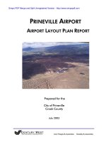
PRINEVILLE AIRPORT AIRPORT LAYOUT PLAN REPORT phần 7 ppt
Bạn đang xem bản rút gọn của tài liệu. Xem và tải ngay bản đầy đủ của tài liệu tại đây (200.36 KB, 15 trang )
CITY OF PRINEVILLE Prineville Airport
CROOK COUNTY Airport Layout Plan Report
fuel storage reserve should be identified in the terminal area(s) represented in the preferred
development alternative.
Airport Utilities
The existing utilities on the airport appear to be adequate for current and projected needs within
existing developed areas of the airport. Potential expansion of facilities on the north side of
Runway 10/28 would require extensions of the water, sewer, electrical, and telephone lines that
serve currently serve the east terminal area.
An increase in fire-related activity at airport may increase demand for water, although the
existing service should be able to provide adequate supply for the level of demand associated
with these operations. Overhead electrical and telephone lines should be buried whenever
possible; new electrical connections to hangars or other airfield developments should also be
placed underground. New airfield electrical requirements include providing power to the PAPIs
and REILs on the runway.
Security
The airport has limited wire fencing on portions of its boundary and chain link fencing around
some hangars. There are no major security concerns at the airport, although providing chain-link
fencing and gates along the entire landside frontage should be considered. Upgrading fencing
around the airport property line or to surround active areas of the airfield may be helpful in
reducing animal incursions.
The airport plans to develop hangars in the area located east of the current airport access road.
The general scheme involves developing a new access road east of the current location while
placing gates at each end of the current road. Since aircraft access would be provided through
this area (across the existing access road) the gates should remain closed and locked. Upgraded
security fencing will also be required in this area in conjunction with the new gates.
Additional flood lighting should be provided around the aircraft parking apron, fueling area, and
hangar areas to maintain adequate security.
FACILITY REQUIREMENTS SUMMARY
The projected twenty-year facility needs for Prineville Airport are summarized in Table 3-8. As
noted in the table, the primary facility requirements include runway and taxiway improvements
for Runway 10/28 and the addition of new hangar space on the airport. Maintaining and
July 2003 3-36 Facility Requirements
Century West Engineering Aron Faegre & Associates Gazeley & Associates
CITY OF PRINEVILLE Prineville Airport
CROOK COUNTY Airport Layout Plan Report
replacing existing pavements represents a significant facility need. Upgrades in airfield lighting
(PAPI, REIL) are important based on the existing level of night operations, particularly by the
locally based corporate aircraft returning to the airport at the end of the day. The development
capacity of the existing east landside facilities is limited, but does have potential for
redevelopment to improve the efficiency of current layouts. This will be addressed in the
alternatives evaluation. The Airport Commission has indicated that development of new
facilities on the north side of Runway 10/28 is already being pursued.
The forecasts of aviation activity contained in Chapter Two anticipate modest growth in activity
that will result in modest airside facility demands beyond existing capabilities. The existing
airfield facilities have the ability to accommodate a significant increase in activity, with targeted
facility improvements. For the most part, the need for new or expanded facilities, such as aircraft
hangars, will be market driven, although there will be significant costs associated with site
preparation, utility extensions, road extensions, and taxiway construction.
July 2003 3-37 Facility Requirements
Century West Engineering Aron Faegre & Associates Gazeley & Associates
CITY OF PRINEVILLE Prineville Airport
CROOK COUNTY Airport Layout Plan Report
TABLE 3-8
FACILITY REQUIREMENTS SUMMARY
Item Short Term Long Term
Runway 10/28
Pavement Maintenance
1
Upgrade Markings to Non-precision Inst.
Widen Runway to 75 Feet
Reconfigure/Expand Rwy 10 Holding Area
(Outside OFZ)
Runway Overlay
Pavement Maintenance
720-foot Runway Extension (north)
Runway 15/33
Pavement Maintenance
1
Pavement Maintenance
Widen Runway to 60 Feet
Extend North End in Conjunction with Rwy
10/28 Parallel Taxiway.
Runway Overlay
Taxiways
Runway 10/28 Parallel Taxiway (new)
Overlay Access Taxiway
Pavement Maintenance
Add AC Hold Lines on All Taxiways
Pavement Maintenance
Taxiways to New Hangar Areas
Runway 15/33 Parallel Taxiway Reserve
Cross Taxiway Reserve
Aircraft Aprons
Reconstruct Terminal Apron
Pavement Maintenance on other Aprons
Pavement Maintenance
Overlay Center Apron
Apron Development Reserves
Agricultural Aircraft
Facilities
None
Secondary Containment Pad with
Collection
Hangars
Reserves for T-hangar and Conventional
Hangar Development
Same
Navigational Aids
and Lighting
PAPI (Rwy 10 & 28)
REIL (Rwy 10 & 28)
Taxiway Edge Reflectors
Flood Lighting (a/c parking & hangar
areas)
VASI/PAPI (Rwy 15 & 33)
Additional Flood Lighting As Required
Fuel Storage
None Fuel Storage Reserve
FBO/GA Terminal
New FBO/Terminal Building Reserve for 2
nd
FBO
Utilities
Extend Electrical to New Facilities Same
Roadways
Extend Roads to New Facilities Same
Security
Terminal Area Fencing; Flood Lighting Same
1. Vegetation control, crackfill, sealcoat
July 2003 3-38 Facility Requirements
Century West Engineering Aron Faegre & Associates Gazeley & Associates
CITY OF PRINEVILLE Prineville Airport
CROOK COUNTY Airport Layout Plan Report
CHAPTER FOUR
AIRPORT DEVELOPMENT ALTERNATIVES &
AIRPORT LAYOUT PLANS
INTRODUCTION
The evaluation of development options at Prineville Airport began with preparation of two
preliminary concepts each offering distinctly different strategies capable of accommodating
forecast facility demand. These preliminary concepts were presented to the Airport Commission
and public for review and comment. The input provided by the Commission and airport users led
to the development of a refined concept. The refined concept included some of the preferred
components of the preliminary concepts and served as the basis for finalizing a preferred
alternative to be depicted on the airport layout plan drawing.
As noted in the forecasts, demand for landside facilities (hangars, aircraft parking, associated
facilities, etc.) within the current 20-year planning period is expected to be moderate. However,
based on uncertainty associated with predicting future activity trends, it is recommended that
facility development areas and reserves be identified to provide long-term development potential.
In addition to protecting the viability of the airport, providing development reserves will
accommodate unexpected surges in demand that may occur in the future.
Overview and detail sheets for each of the preliminary concepts and the refined concept were
prepared, and are presented as Figure 4-1 through Figure 4-6 later in this chapter. The set of
airport layout plan drawings is presented with narrative descriptions in the second section of this
chapter. These reduced size drawings are for general reference only. Full-size scaled drawings
are provided separately for formal review and comment.
DEVELOPMENT CONCEPT “A”
Concept “A” involves the redevelopment of the existing east-side facilities located between the
ends of Runways 28 and 33, Highway 126 and the main access taxiway. A primary element of
this concept is the consolidation of existing government-related fire response activities to a single
area. Currently, fire related aircraft and operations facilities are scattered throughout the east
July 2003 4-1 Alternatives/Airport Layout Plans
Century West Engineering Aron Faegre & Associates Gazeley & Associates
CITY OF PRINEVILLE Prineville Airport
CROOK COUNTY Airport Layout Plan Report
side of airport. Consolidating all government-related activities to a single area would provide
new efficiencies to the users and would significantly improve land utilization on the airport.
Concept “A” is depicted in Figures 4-1 and 4-2.
This concept attempts to maximize the efficiency of existing developed areas (east landside area)
to address facility needs before proceeding with the development of other parts of the airport.
This approach requires a combination of new development and redevelopment to improve
existing space utilization and maximize landside capacity. The basic planning principle involved
in this option is to improve the configuration and operational efficiencies of different airport
functions by eliminating the patchwork pattern of development that has occurred in favor of
efficient, consolidated development. Prineville Airport has the unique opportunity to consider
this type of approach because of its substantial land base.
Because the elements of redevelopment do not typically occur simultaneously, this concept
allows for incremental development of hangars and reuse of aircraft parking areas, etc., in the
east landside area until more substantial redevelopment occurs. However, since the government
fire response facilities are scattered throughout the east end of the airport, their consolidation and
relocation will need to occur before the full redevelopment potential of the east area can be
realized.
In addition to improving overall land utilization, a primary advantage of this concept is the ability
to maximize existing investments in facilities and infrastructure. By consolidating new
development activity into areas that are readily developable (existing road access, utilities, etc.),
this option allows the airport to defer the major infrastructure improvements that will be required
when expanding into undeveloped areas. The primary potential disadvantage of this concept is
the potential to impact existing users, which can range from minor inconvenience to relocation.
However, the prospect of developing new more efficient facilities often provides users with
expansion opportunities that may not exist with current facilities. This approach also requires
considerably more effort by the airport sponsor to coordinate the reconfiguration of existing
developments, renegotiate existing leases, etc., when compared to developing bare ground.
A previously planned realignment of the main airport access road (depicted) has been integrated
into this concept and is essential to allow development of aviation related-facilities east of the
existing access road, which currently cannot be accessed by aircraft without taxiing across the
roadway. With the planned roadway changes, this area can accommodate considerably more
development of aircraft hangars, parking apron, FBO facilities, fuel storage, etc. An airport-
related commercial/industrial area is identified along the east side of the area. Because this lease
area does not have direct airside access it is well suited to accommodate airport-related aviation
and non-aviation uses.
July 2003 4-2 Alternatives/Airport Layout Plans
Century West Engineering Aron Faegre & Associates Gazeley & Associates
CITY OF PRINEVILLE Prineville Airport
CROOK COUNTY Airport Layout Plan Report
The southeast corner of the terminal area is identified as a GA redevelopment area, which
provides space for new hangars, aircraft maintenance, etc. The existing government-related fire
operations and support facilities (interagency operations building, equipment storage yard,
helipads, etc.) would be relocated to the north side of Runway 10/28 to a large consolidated
government operations area. The existing fixed based operator (FBO)/GA terminal building
would be replaced by a new building (relocated) to the large aircraft apron. In this option, the
large aircraft apron would be reconfigured to provide parking for itinerant corporate aircraft and
smaller aircraft, aircraft fueling, etc. The single engine air tanker (SEAT) loading and operations
area currently located at the north end of the large apron would be relocated to the consolidated
government operations area on the north side of Runway 10/28. The area located along the back
(eastern) edge of the apron is reserved for larger conventional hangars.
Concept “A” also includes a 720-foot runway extension (as recommended in the facility
requirements assessment) and the interior access taxiway depicted on the 1994 airport layout
plan. The consolidated government aviation/operations area is located near the east end of
Runway 10/28. This area is envisioned as a large lease (20+ acres) which would be developed by
the agencies based on their operational needs. The site provides convenient airside and landside
access and is large enough to accommodate a combination of aviation facilities (hangars, aircraft
parking, retardant loading areas, water storage, fuel storage, etc.) and operations facilities
(offices, crew quarters, maintenance facilities, equipment storage, etc.). The initial development
of the eastern-most area north of Runway 10/28 minimizes the distance required for utility
extensions. This also allows future airport development to occur in a westerly direction
incrementally as demand occurs. A new north airport access road is shown extending from an
existing service point on Highway 126.
DEVELOPMENT CONCEPT “B”
Concept “B” accommodates all future landside facility needs on the north side of Runway 10/28.
This option provides the airport with a “clean sheet of paper” that provides a clear development
path without the constraints of redeveloping existing areas. Concept “A” is depicted in Figures
4-3 and 4-4.
The consolidated government aviation/operations area described in Concept “A” is also included
in Concept “B.” However, in this option, the government area is located near the mid-point of
Runway 10/28 and areas of potential property acquisition are identified along the northern edge
of the airport. A large area (50+ acres) is identified for general aviation development and
development reserves. The GA area extends from the eastern end of the designated government
area to Highway 126. A full-length parallel taxiway is located on the north side of Runway
July 2003 4-3 Alternatives/Airport Layout Plans
Century West Engineering Aron Faegre & Associates Gazeley & Associates
CITY OF PRINEVILLE Prineville Airport
CROOK COUNTY Airport Layout Plan Report
10/28 to serve new developments. A new north airport access road is shown extending from an
existing service point on Highway 126.
The primary advantage of this option involves the simplicity of developing currently
undeveloped areas, particularly the ability to construct facilities without significant space or
configuration constraints. The primary disadvantages of this option involve the cost of extending
utilities and access roadways beyond currently developed areas and the effects of spreading out
development on the airfield. Spreading facilities out over a large area also requires additional
airfield improvements such as access taxiways, which can increase the airport’s initial capital
costs and the life cycle costs for airfield pavements. Locating general aviation facilities, such as
FBO or fueling on both sides of a main runway creates operational challenges for airport
management, service businesses, and users. For smaller airports that are unable to support
multiple FBOs or multiple fixed-point fueling facilities, the use of mobile fuel trucks can
eliminate the need for lengthy aircraft taxiing between aircraft storage areas and fuel.
REFINED CONCEPT
Based on the review of the preliminary alternative concepts, the Prineville Airport Commission
identified several items from each concept to be incorporated into a preferred alternative. The
general consensus among the Airport Commission was that the remaining available space on the
east side of the airport should be developed first, with additional facilities then developed on the
north side of Runway 10/28. The Commission supported the concept of redeveloping east side
facilities where feasible, although there was no strong interest expressed in immediately pursuing
the relocation of government fire-related facilities to the north side of Runway 10/28. As a
result, the “refined concept” retained the general theme of Concept “A” but also identifies large
development areas for general aviation and government aviation facilities on the north side of
Runway 10/28. The “refined concept” is depicted in Figures 4-5 and 4-6.
The east landside area is depicted with a combination of new hangars and taxilanes on currently
unused land and longer-term hangar construction (reserves) in the potential redevelopment areas,
including the fire-related facilities (dispatch center, helicopter parking areas, etc.). The northern
section of the east landside area is planned to accommodate two T-hangar buildings in the areas
nearest the main access taxiway, with additional space for multiple conventional hangars on the
east side of the existing access road (to be relocated). The area surrounding the larger central
apron is planned for apron expansion, an FBO/GA terminal reserve, and space for larger
conventional hangars (business related use). The previously-defined configuration of long
narrow lease lots may need to be altered based future tenant needs. A third T-hangar site is
identified near the southeast corner of the large apron with additional taxilane access provided to
both sides of the building. Conventional hangars can be accommodated in a variety of locations
July 2003 4-4 Alternatives/Airport Layout Plans
Century West Engineering Aron Faegre & Associates Gazeley & Associates
CITY OF PRINEVILLE Prineville Airport
CROOK COUNTY Airport Layout Plan Report
on either side of the existing access road, while T-hangar locations are in short supply. The
shortage of readily developable space for T-hangars in the east landside area makes it particularly
important to reserve these areas.
The southeast corner of the airport (including the terminal area) provides longer term
redevelopment sites for hangars if the government-related facilities are relocated. Additional
taxiway/taxilane access is depicted from the main access taxiway. This concept depicts the
existing FBO area being redeveloped as aircraft parking. Additional taxiway access is extended
into the adjacent newly developed hangar area. This reconfiguration will be deferred indefinitely
if the existing FBO building site is retained.
Several large development areas and development reserves are designated on the north side of
Runway 10/28 for general aviation, agricultural, military and government aviation use. The
government fire-related lease area is located between the end of Runway 28 and Highway 126.
Based on direction from the Airport Commission, the government aviation lease area has been
expanded from the original Concept “A” and now extends to the north edge of the airport with a
new access road routed along the northern edge of airport property. The general aviation
development area abuts the government area and extends to the west along Runway 10/28 until
reaching an existing triangular shaped leased area (approximate area depicted – to be refined on
ALP). A military lease area has also been added on the north side of Runway 10/28 (west of
Runway 15/33). This area is intended to accommodate a combination of aviation and related
uses with road access provided via Huston Lake Road. The leased area located near the center of
Runway 10/28 eliminates the option of extending vehicle access from east to west on the north
side of the runway (without acquiring additional property).
An alternative AG lease area is located near the west end of Runway 10/28. In the event that the
existing AG facilities located near the east end of Runway 10/28 need to be relocated to
accommodate other development, this alternative site is reserved for that purpose. The facilities
consist of an unpaved access road, a loading/containment pad, and a taxiway connection to the
parallel taxiway/runway. A lease area would be defined adjacent to the pad for the AG operators
to store vehicles, equipment and chemicals/pesticides. All future AG aircraft facility
development on the airport should be consolidated in a single area with a common-use pad(s) that
meet all state and federal regulatory requirements for spill containment. Additional pads can be
added in the event that demand levels increase (multiple aerial applicator aircraft operating
simultaneously). As with the military area described above, vehicle access to this area will be
limited to Huston Lake Road.
July 2003 4-5 Alternatives/Airport Layout Plans
Century West Engineering Aron Faegre & Associates Gazeley & Associates
CITY OF PRINEVILLE Prineville Airport
CROOK COUNTY Airport Layout Plan Report
The refined concept includes a north-side parallel taxiway on Runway 10/28; a south-side
parallel taxiway on Runway 15/33; and an interior access taxiway that would extend from the
new terminal area to near the midpoint of the primary runway.
The refined concept also includes two ODOT highway clearance zones, with 400-foot radii,
centered on the existing airport roadway intersections with Highway 126. According to City of
Prineville Planner Dick Brown, plans exist to construct a major highway interchange in the
vicinity of the east end of the airport, perhaps at one these two points. In order to protect the
potential geometry associated with a highway interchange, no airport-related developments have
been planned (aside from roadways, which may require redesign) within these 400-foot clearance
areas.
In providing a balanced approach to addressing the region’s transportation planning needs, it is
equally important to protect potential highway interchange areas from incompatible interim
developments and to protect the airport from any future highway developments that could create
obstructions to its airspace. No highway reconfiguration should be permitted that creates
obstructions to any of the airport’s protected airspace surfaces, particularly the approach surfaces
to Runways 28 and 33, which cross directly over Highway 126.
July 2003 4-6 Alternatives/Airport Layout Plans
Century West Engineering Aron Faegre & Associates Gazeley & Associates
CITY OF PRINEVILLE Prineville Airport
CROOK COUNTY Airport Layout Plan Report
FIGURE 4-1: DEVELOPMENT CONCEPT “A”
July 2003 4-7 Alternatives/Airport Layout Plans
Century West Engineering Aron Faegre & Associates Gazeley & Associates
CITY OF PRINEVILLE Prineville Airport
CROOK COUNTY Airport Layout Plan Report
FIGURE 4-2: DEVELOPMENT CONCEPT “A” (DETAIL)
July 2003 4-8 Alternatives/Airport Layout Plans
Century West Engineering Aron Faegre & Associates Gazeley & Associates
CITY OF PRINEVILLE Prineville Airport
CROOK COUNTY Airport Layout Plan Report
FIGURE 4-3: DEVELOPMENT CONCEPT “B”
July 2003 4-9 Alternatives/Airport Layout Plans
Century West Engineering Aron Faegre & Associates Gazeley & Associates
CITY OF PRINEVILLE Prineville Airport
CROOK COUNTY Airport Layout Plan Report
FIGURE 4-4: DEVELOPMENT CONCEPT “B” (DETAIL)
July 2003 4-10 Alternatives/Airport Layout Plans
Century West Engineering Aron Faegre & Associates Gazeley & Associates
CITY OF PRINEVILLE Prineville Airport
CROOK COUNTY Airport Layout Plan Report
FIGURE 4-5: REFINED CONCEPT
July 2003 4-11 Alternatives/Airport Layout Plans
Century West Engineering Aron Faegre & Associates Gazeley & Associates
CITY OF PRINEVILLE Prineville Airport
CROOK COUNTY Airport Layout Plan Report
FIGURE 4-6: REFINED CONCEPT (DETAIL)
July 2003 4-12 Alternatives/Airport Layout Plans
Century West Engineering Aron Faegre & Associates Gazeley & Associates