Trustworthy maps in real world
Bạn đang xem bản rút gọn của tài liệu. Xem và tải ngay bản đầy đủ của tài liệu tại đây (3.63 MB, 15 trang )
J OURNAL OF S PATIAL I NFORMATION S CIENCE
Number 20 (2020), pp. 5–19
doi:10.5311/JOSIS.2020.20.654
I NVITED A RTICLE
Trustworthy maps
Amy L. Griffin
School of Science, RMIT University, Australia
Received: March 7, 2020; accepted: April 26, 2020
Abstract: Maps get used for decision making about the world’s most pressing problems
(e.g., climate change, refugee crises, biodiversity loss, rising inequality, pandemic disease).
Although maps have historically been a trusted source of information, changes in society
(e.g., lower levels of trust in decision makers) and in mapmaking technologies and practices (e.g., anyone can now make their own maps) mean that we need to spend some time
thinking about how, when, and why people trust maps and mapmaking processes. This is
critically important if we want stakeholders to engage constructively with the information
we present in maps, because they are unlikely to do so if they do not trust what they see.
Here I outline three questions about trust and maps that I think need research attention.
First, how can we focus map readers’ attention on the trustworthiness of mapped data,
especially if trustworthiness changes as in the case of real-time data sources? Second, does
presenting uncertainty information on maps affect the level of trust map readers have in the
map, and if so, does trust vary depending on how the uncertainty information is presented?
Finally, how does virality affect trust? Are viral maps less trusted? The time and resources
required to develop a better understanding of how trust in maps might be changing will
be repaid. The world needs good information to guide policy- and decision-making. Well
designed maps can help stakeholders to work together to solve problems, but only if they
are trusted.
Keywords: trust, maps, mapping, visualization, COVID-19
1
Introduction
As the decade turned to the 2020s it has sometimes seemed that the number of the world’s
critical and pressing problems is increasing. Climate change, refugee crises, biodiversity
loss, rising inequality, and pandemic disease all come immediately to mind. None of these
problems is solely local (though their impacts vary locally), and addressing them requires
an understanding of processes and interactions across multiple scales involving actions by
many different stakeholders who often have different agendas. There is a sense that these
c by the author(s)
Licensed under Creative Commons Attribution 3.0 License
CC
6
G RIFFIN
problems, some of which are longstanding, are more intractable than ever. They are made
more challenging by developments in the political sphere that have left citizens trusting
their governments less than they used to [7, 26, 34], and many individuals feel incapable
of contributing to change, leading to disengagement [36]. After being asked to write this
vision piece, I have been thinking about how spatial information science research, and
in particular, research on cartography and visualization, can contribute to solving these
important problems and building a healthier, more equitable planet.
Maps get used for supporting public and private discussions about problems. They
have historically been a trusted source of information despite the fact that no single map
ever tells the whole truth [21, 22]. Maps are perhaps undeservedly trusted given that they
are usually made to serve their maker’s interests, as has been convincingly argued by Denis
Wood and other critical cartographers [5, 45, 46]. But changes in mapmaking technologies
and in the availability of spatial data have widened who is able to make maps, and anyone
with access to the Internet and a basic computer can now make maps to serve their own
interests, whatever they may be. Fast forward ten years into the future and we may find
that many maps are not even made by humans, but by bots. These trends, combined with
the “post-truth” politics practiced in a growing number of countries may mean that people
will trust maps less than they have historically.
Which maps should we trust when we use them to explore problems and enact change
in the world? The answer to this question is more unclear than ever, other than perhaps
to say that the map you can trust the most is the one you made yourself, assuming you
have some awareness of your own potential blind spots and are an informed consumer of
spatial information who can evaluate the quality of the data you are using to make your
map. Therefore, a theme that I think needs much more research attention and focus in
the coming years is trust, specifically understanding how, when, and why people trust
maps and mapping processes. If we want stakeholders to engage constructively with the
information we present in maps, they first need to trust what they see.
One place that we probably need to start is by considering what the concept of trust
means in the context of maps and mapping. Do we trust information because we know it is
true? Because it is reliable? Because it fits our world view? Must it be all of these things to
be trustworthy? Space precludes a full exploration of how we might conceptualize trust in
the context of maps here in this piece, but it is a question that also requires some research
thinking and attention. In the remainder of this piece, I highlight a number of specific
aspects of maps and trust that I believe need further research and I illustrate how they are
exemplified in maps of a current global challenge, the COVID-19 pandemic.
2
Trust: which information?
A fundamental decision when creating any map is the choice of which source of information to use. Pre-Internet, spatial information was (relatively) hard to come by.1 It was often
held closely in government departments or had to be painstakingly compiled by hand.
Some of the authority map readers ascribe to maps probably derives from this historical information asymmetry. Developments in communication and computing technology have,
of course, greatly reduced the friction of compiling and distributing many sources of spa1 I acknowledge that in some locations or for some topics, information is still difficult to obtain. Nevertheless,
there has been a marked increase in the availability of mappable data in the last two decades.
www.josis.org
T RUSTWORTHY M APS
7
tial data. This has simultaneously put pressure on governments to open up their data to
citizens—witness the growth of open data initiatives [18]—and made it easier for groups of
citizens to coordinate and compile their own data when authorities either did not hold it or
were unwilling to release it at an affordable price, if at all (e.g., [25]). Journalists, likewise,
have been impacted by these developments because their trusted role as the suppliers of
the authoritative version of an event can also now be more easily challenged by individuals
who have their own data [40]. Crowd-sourcing capabilities and the capacity for those who
have not traditionally been considered to be information gatekeepers to compile their own
spatial information that may challenge the perspectives of those in positions of power is
perhaps even more important than it otherwise might have been given the commonplace
practice today of establishing a “single source of truth” about a particular phenomenon
within many government agencies and corporate organizations.
As a map reader, being capable of critically interrogating a map to understand the extent to which its information can be trusted is more important than ever. There are now
multiple sources of spatial information about many phenomena, usually generated using
different methodologies, with impacts on the datasets’ quality and trustability [10]. Although crowdsourcing efforts have increased the availability of data, they also bring new
challenges to selecting trustable data, such as differing levels of skill among data compilers [14, 27, 51] and problems such as digital vandalism [1]. Lush et al. [19] present one approach to communicating the trustworthiness of spatial data through a GEO label approach
that borrows from eCommerce trust triggers. Their evaluation of the labels was limited to
spatial data experts rather than non-expert users. However, other research suggests that
this approach could perhaps be successful for non-experts. In a study of non-expert web
GIS users, Skarlatidou et al. [32] found that participants focused on interface design elements rather than metadata when judging whether data in a web GIS were trustable, reconfirming that when relevant elements are not perceptually salient, visualisation users can
make incorrect inferences about information [8]. Lush et al.’s GEO label approach might
make the metadata-derived information salient enough that non-expert users pay attention
to it.
Many datasets are now being generated by automated sensors or machines, presenting
additional challenges for understanding their trustworthiness. For example, Crampton et
al. [6] identified observations generated by bot activity within their geosocial dataset, and
it is likely that we will see increasing levels of non-human actants generating data that
describe human activities. Even when they measure accurately, sensors are not always
trustworthy sources of information, as a recent performance art project highlighted when
a Berlin artist was able to alter the traffic congestion levels displayed in Google Maps (and
the consequent routing of vehicles through that part of the city) when he dragged a wagon
filled with 99 smartphones running the Google Maps app through the city’s streets [42].
With growing use of real-time data on maps, trustworthiness will be a dynamic property
of data, making it even more challenging to evaluate as a data consumer.
We will need to find ways of communicating about the trustworthiness of datasets that
work for both mapmakers and map readers and that account for dynamic trustworthiness
when we use real-time data.
JOSIS, Number 20 (2020), pp. 5–19
8
3
G RIFFIN
Trust: communicating uncertainty?
Trustworthiness is not only a property of the whole dataset, but can vary spatially across a
dataset. Moreover, even with a generally trustworthy dataset, there are limits to the level
of trust a map reader should place in the map because of uncertainty in the information.
Knowledge of uncertainty associated with particular pieces of information helps the map
reader to answer the question of how much trust to put in that information.
Many researchers believe that communicating uncertainty information to map readers
will help them to make more effective and accurate use of the information and increase
their trust in science and/or the data producer [30]. Significant amounts of research effort have been directed to developing and testing methods for visually representing uncertainty in maps and in other types of information graphics (see [16] for a recent review of
this work). There have also been numerous studies that focused on decision making with
uncertain spatial information (see [15] for a recent review).
However, there has been little empirical study directed to how judgements of trust derived from uncertainty representations propagate further into the map reader’s decisionmaking process. Much of the research that has been conducted on uncertainty and decision
making with maps relies on indirect measurements such as decision confidence [15]. Only a
few studies have examined trust directly. This trust-focused work has aimed to understand
the extent to which analysts trust visual analytics applications and considered how uncertainty propagates through visual analytics workflows during an analysis [29]. The authors
suggested that building trust in an outcome (i.e., the mapped results of an analysis) might
first require building trust in the analysis system that produced the outcome.
An audience of visual analytics application users can be expected to have a reasonable
amount of knowledge about different types of uncertainty and how uncertainty might influence the quality of inferences in analytical reasoning processes. Less is known about
whether representing uncertainty is helpful and whether it increases or decreases trust in
the information among audiences who have less technical knowledge about uncertainty,
such as members of the general public. An intriguing finding from a recent study suggests
that, at least in some cases, showing uncertainty to non-experts might decrease their trust
in information that is critical to making a good decision [17]. This study found that participants were more likely to choose to buy a house in a zone at high risk of a natural hazard
when uncertainty information was depicted, perhaps because they reasoned that the zone
might be less at risk because the risk information was uncertain. In other decision-making
contexts, at least some evidence from other fields indicates that knowledge of uncertainty
can be paralysing and can lead to inaction [20]. Therefore we must ask whether presenting
uncertainty information is even beneficial in all contexts.
An urgent question therefore that needs answering is whether and how presenting uncertainty information affects the level of trust map readers have in the mapped information.
4
Trust: viral maps
Fake news, deep fakes, and social media posts generated by troll farms have become prominent topics of conversation in the news media and academic circles, if not in everyday life.
Few studies have been carried out to examine the extent to which maps have been participants in modern misinformation attempts. Given their long history of use as propaganda
www.josis.org
T RUSTWORTHY M APS
9
tools [33] and the fact that they are often attention grabbing, we should suspect that maps
also are being used for misinformation in these new media and platforms. Robinson [28]
demonstrated one approach that might help to unearth the provenance of maps that go
viral. He suggests, for example, that image matching using machine learning platforms
such as Google Cloud Vision together with URL tracing could be used to identify botpromoted maps that have been disseminated while attempting to conceal their origins or
promoters. Journalism desks are experimenting with artificial-intelligence-generated news
stories [39], and it’s likely that we will also see maps made by bots in the not too distant
future. While even recent efforts (e.g., [12]) have limitations or are targeted primarily to
improving upstream map design processes like updating map data (e.g., [4]), the technology will inevitably continue to improve.2 How much should we trust a machine-generated
map? This is an open question that is yet to be answered.
A study of persuasive online maps found that a large proportion of maps in the study
sample adopted the authoritative rhetorical style, which tended to promote trust in the
map [24]. Shannon and Walker [31] argued but did not empirically demonstrate that the
cultural authority ascribed to maps through their presumed scientific objectivity can help
viral maps to be perceived as being more legitimate than other viral content. However,
their interactions with readers of their own viral maps also demonstrated skepticism and
mistrust among map readers when what they saw in the map did not match their own
lived experiences, whether that mismatch was due on the one hand to the mapmaker’s
use of messy data to create a map very quickly, or on the other hand, to the map reader’s
misinterpretation of what the dot locations represent on a dot density map. An important
research need is empirical work to understand the extent to which viral maps remain trustworthy among readers as well as how design decisions might modify these perceptions of
trustworthiness [28].
Muehlenhaus [24] argued that the easy sharing of maps through social media makes it
more important than ever before to educate map readers to be critical consumers of visual
media. Sharing maps can take them out of their original context, causing misinterpretation, as in the recent example of readers inferring that the entire continent of Australia was
simultaneously on fire, not realizing that they were looking at a screenshot from a temporal composite of fire hotspots [9]. Cartographers can help prevent misinterpretation by
considering how to more transparently communicate how the map was constructed [13].
Harley first urged cartographers to do this back in 1991, but it may be that threat posed by
deep fakes and other forms of misinformation to the perception that maps are trustworthy
will be what finally motivates practicing professional cartographers to engage with his call
for an ethically informed cartography when the more benign, common problem of a map
being viewed outside of its original context has not. Even if such an effort is successful,
there remains the challenge that Web 2.0 environments enable those without formal cartographic training to make maps, also raising the question of how to build community norms
about ethical practice among mapmakers who may not realise the ethical implications of
their maps [35].
2 There have been periodic waves of scientific effort directed to developing systems that can replace human
cartographers. Despite a rash of work in the 1980s and early 1990s, no expert system has yet caught on widely.
Contemporary artificial intelligence techniques show more promise.
JOSIS, Number 20 (2020), pp. 5–19
10
5
G RIFFIN
A brief illustration using maps of COVID-19
A current global challenge the world is grappling with is the pandemic sparked by the
novel coronavirus. Contagious infectious diseases are inherently geographical phenomena
because the movement of people greatly influences how they spread. For that reason, maps
are being used extensively for purposes ranging from planning where to deploy medical
resources to communicating with citizens about the risks of the situation to understanding
where the disease might spread next at a given point in time. In this section, I examine a
selection of recent coronavirus maps to illustrate how a better understanding of the three
dimensions of trust I outlined above could help us to make better maps.
There are many maps of coronavirus case or death counts and/or rates. If one does a
Google search on “coronavirus map”, the first result is a map from Wikipedia (Figure 1).
The dataset underpinning this map also comes from Wikipedia, and is a mashup of sources
of highly varied levels of authority and reliability. Wikipedia, moreover, can be edited by
anyone, so the data quality can vary depending on who has contributed the edit, their
knowledge of reliable sources, and (sometimes) on their politics or other motivations. In
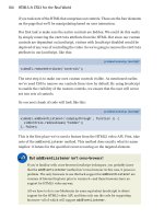
fact, when inspecting the edit history for the Wikipedia page whose information is fed into
this map, it was not hard to find one such instance (Figure 2). Although any errors or edits
made with political or mischievous motivations may be corrected quickly by other editors,
anyone inspecting the map at a particular point in time may be looking at unreliable information, meaning that the trustworthiness of the information as well as the information
itself varies dynamically.
If one accepts that Wikipedia’s data may not be sufficiently trustworthy, where can one
find more authoritative, if slightly less timely, data? Figure 3 is a map published by the
World Health Organization (WHO). Although it may also suffer from data quality issues
such as different data reporting practices in different countries, it only includes cases that
meet the WHO case definition, a data quality standard set by the WHO [48].
www.josis.org
11
T RUSTWORTHY M APS
Figure 1: Wikipedia’s COVID-19 map on 20 April 2020 [43].
Figure 2: Edit history documenting discussion about two politically motivated edits to
COVID-19 figures (one edit, later overturned) [44].
JOSIS, Number 20 (2020), pp. 5–19
12
G RIFFIN
Figure 3: World Health Organization’s Map of COVID-19 cases on 20 April 2020 [47].
In the early stages of a pandemic, particularly when the organism causing the pandemic is novel (i.e., not known to human immune systems), many things are unknown
and uncertain. For example, although we can count the number of people displaying
clinical signs and symptoms, we do not currently know what proportion of all infected
persons are asymptomatic carriers of the virus and therefore do not present themselves
to the healthcare system. Thus widespread testing is critical for answering questions like
“what is the infection rate” or “what is the case fatality rate?” Without knowing the total
number of infected persons, any estimate of these rates will be uncertain. Moreover, testing
rates vary geographically, meaning the uncertainty associated with the rates also varies geographically. Good knowledge of both these rates is important for monitoring the success
of intervention strategies.
To provide a truthful picture of the level of certainty associated with infection rates—
they are more certain when more tests are being done on a per capita basis—maps of cases
www.josis.org
T RUSTWORTHY M APS
13
Figure 4: Screenshot of an interactive map comparing numbers of cases and tests in the
U.S. on 20 April 2020, published on Politico Magazine’s website [11].
should also include information about testing rates.3 Yet despite the information being
available [49], few mapmakers are making maps that represent or otherwise account for
testing levels. Figure 4 is an example of a map that does. This map provides an implicit
representation of uncertainty, which must be inferred from a comparison of the two counts
plus knowledge of the state’s population, which is not represented on the map. I was
unable to find any examples of COVID-19-related maps that explicitly represented uncertainty. Although the benefit of helping public health decision makers understand the
limitations of mapped data is clear, perhaps some mapmakers believe that the public will
not understand data uncertainty if it is shown on the map or that they may trust the map
less if uncertainty is acknowledged. There has not been much direct study of whether the
3 There
is the additional issue of the quality of information being reported by different state or national public
health authorities, which varies. For some discussion of this point related to data from the United States, see
the Covid Tracking Project’s website [37]. The website also provides advice on visualizing the project’s data and
includes clear directives: “include the denominator” and “don’t ignore data uncertainty” [38].
JOSIS, Number 20 (2020), pp. 5–19
14
G RIFFIN
public will trust maps less if uncertainty is represented in them, but a recent study that included verbal and numeric descriptions of uncertainty associated with data demonstrated
that there was only a very small decrease in trust when uncertainty information was provided, and that numeric descriptions decreased levels of trust less than verbal descriptions
did [41].
Figure 5: Screenshot from Johns Hopkins University’s COVID-19 Dashboard, a map of the
pandemic that went viral [3].
Maps of COVID-19 are everywhere. They appear in blogs, are published by mapping
companies and academics, and appear in newspapers and other periodicals. Some of these
maps could be described as having gone viral. It’s not clear whether the Johns Hopkins
COVID-19 Dashboard (Figure 5) circulated so widely simply because it was one of the first
maps of COVID-19 to be published (it was first published on 22 January 2020) or because,
at least to Western eyes, its color choices connote danger and urgency: a black background
and saturated red symbols.4 Nevertheless, its design is emotionally arousing, especially in
comparison with the rather staid, neutral appearance of the WHO map (Figure 3), which
perhaps epitomizes the authoritative style that Muehlenhaus [23] described in his study of
rhetorical styles and persuasive geocommunication. It’s possible the COVID-19 dashboard
appears authoritative because it is a dashboard, and despite its use of strong colors rather
than the more neutral palette that is typical in the authoritative rhetorical style. Another
map that went viral first appeared in a tweet from a UK research team that modeled the
movement of travellers from Wuhan. The tweeted map was misinterpreted by many news
outlets, beginning with an Australian television broadcast, from which it was shared more
than seven million times [2]. The news report described the map as showing locations to
which residents of Wuhan had fled. In fact the map was a map of all of the airline flight
routes across the world, and was an input into the researchers’ model in a 2012 paper.
4 This map was so popular that it was targeted by cybercriminals who developed a fake version of the dashboard that concealed malware, hoping readers would stumble upon the fake version and unwittingly infect their
computers [50].
www.josis.org
T RUSTWORTHY M APS
15
Minimizing the damage caused by the COVID-19 pandemic is a monumental challenge
for the world. Maps can and are playing an important role in these efforts. But for them
to make the best contribution they can make to the decisions that individual citizens and
government decision makers take, we need trustworthy maps. Here I provided a few examples of how not knowing whether a given map can or should be trusted (and why it
should or should not be trusted) makes maps work less well than they might if they were
trustworthy.
6
Conclusion
No mapmaker wants to make a map that is dismissed by its readers. The cultural authority
conferred on maps has enabled cartographers to be a bit lazy—to avoid thinking as much as
we perhaps should about the relationship between maps and trust. Changes in the world
and in mapmaking practices might force us to divert more of our attention in that direction. The world needs good information to guide policy- and decision-making, given the
number of critical global problems that threaten the health of our population and planet.
Well designed maps can play a role in helping stakeholders to work together to solve these
problems, but only if they are trusted.
Acknowledgments
I would like to thank the JOSIS editors for the suggestion to add a discussion of COVID19 maps as well as Matt Beaty for a number of insightful observations that improved this
work.
References
[1] B ALLATORE , A. Defacing the Map: Cartographic Vandalism in the Digital Commons.
The Cartographic Journal 51, 3 (2014), 214–224. doi:10.1179/1743277414y.0000000085.
[2] BBC N EWS R EALITY C HECK T EAM. Coronavirus: How a Misleading Map Went
Global. 2020. Last Accessed 24 April
2020.
[3] C ENTER FOR S YSTEMS S CIENCE AND E NGINEERING (CSSE) AT J OHNS H OPKINS U NI VERSITY (JHU). COVID-19 Dashboard. 2020.
Last Accessed 20 April 2020.
[4] C HU , C., Z HMOGINOV, A., AND S ANDLER , M. CycleGAN, A Master of Steganography. arXiv preprint (2017), arXiv:1712.02950.
[5] C RAMPTON , J. W.
Maps as Social Constructions: Power, Communication and Visualization.
Progress in Human Geography 25, 2 (2001), 235–252.
doi:10.1191/030913201678580494.
JOSIS, Number 20 (2020), pp. 5–19
16
G RIFFIN
[6] C RAMPTON , J. W., G RAHAM , M., P OORTHUIS , A., S HELTON , T., S TEPHENS , M.,
W ILSON , M. W., AND Z OOK , M. Beyond the Geotag: Situating “Big Data”and Leveraging the Potential of the Geoweb. Cartography and Geographic Information Science 40, 2
(2013), 130–139. doi:10.1080/15230406.2013.777137.
[7] E DELMAN.
Edelman Trust Barometer Global Report 2020.
https://www.
edelman.com/sites/g/files/aatuss191/files/2020-01/2020%20Edelman%20Trust%
20Barometer%20Global%20Report.pdf, 2020. Last Accessed 28 February 2020.
[8] FABRIKANT, S. I., H ESPANHA , S. R., AND H EGARTY, M.
Cognitively Inspired and Perceptually Salient Graphic Displays for Efficient Spatial Inference
Making. Annals of the Association of American Geographers 100, 1 (2010), 13–29.
doi:10.1080/00045600903362378.
[9] G UERSCHMAN , J. P.
6 Things to Ask Yourself Before You Share
a Bushfire Map on Social Media.
/>6-things-to-ask-yourself-before-you-share-a-bushfire-map-on-social-media-129557,
2020. Last Accessed 6 March 2020.
[10] H ARVEY, F. Crowdsourcing Geographic Knowledge, Volunteered Geographic Information (VGI) in Theory and Practice. In Crowdsourcing Geographic Knowledge,
D. Sui, S. Elwood, and M. F. Goodchild, Eds. Springer, Dordrecht, 2013, pp. 31–42.
doi:10.1007/978-94-007-4587-2_3.
[11] J IN , B.
Live Tracker: How Many Coronavirus Cases Have Been Reported in Each U.S. State?
/>coronavirus-testing-by-state-chart-of-new-cases/, 2020. Last Accessed 20 April 2020.
[12] K ANG , Y., G AO , S., AND R OTH , R. E. Transferring Multiscale Map Styles Using
Generative Adversarial Networks. International Journal of Cartography 5, 2-3 (2019),
115–141. doi:10.1080/23729333.2019.1615729.
[13] K ENT, A.
Trust Me, I’m a Cartographer: Post-truth and the Problem
of Acritical Cartography.
The Cartographic Journal 54, 3 (2017), 193–195.
doi:10.1080/00087041.2017.1376489.
[14] K ESSLER , C., AND DE G ROOT, R. T. A. Trust as a Proxy Measure for the Quality of Volunteered Geographic Information in the Case of OpenStreetMap. In Geographic Information Science at the Heart of Europe, D. Vandenbroucke, B. Bucher, and J. Crompvoets,
Eds. Springer, Cham, Switzerland, 2013, pp. 21–37. doi:10.1007/978-3-319-00615-4_2.
[15] K INKELDEY, C., M AC E ACHREN , A. M., R IVEIRO , M., AND S CHIEWE , J. Evaluating
the Effect of Visually Represented Geodata Uncertainty on Decision-making: Systematic Review, Lessons Learned, and Recommendations. Cartography and Geographic Information Science 44, 1 (2017), 1–21. doi:10.1080/15230406.2015.1089792.
[16] K INKELDEY, C., M AC E ACHREN , A. M., AND S CHIEWE , J. How to Assess Visual Communication of Uncertainty? A Systematic Review of Geospatial Uncertainty Visualisation User Studies. The Cartographic Journal 51, 4 (2014), 372–386.
doi:10.1179/1743277414y.0000000099.
www.josis.org
T RUSTWORTHY M APS
17
[17] K ÜBLER , I., R ICHTER , K.-F., AND FABRIKANT, S. I. Against All Odds: Multicriteria
Decision Making with Hazard Prediction Maps Depicting Uncertainty. Annals of the
American Association of Geographers (2019), 1–23. doi:10.1080/24694452.2019.1644992.
[18] L AURIAULT, T. P. Open Spatial Data. In Understanding Spatial Media, R. Kitchin,
T. P. Lauriault, and M. W. Wilson, Eds. SAGE Publications, London, 2018, pp. 95–109.
doi:10.4135/9781526425850.
[19] L USH , V., L UMSDEN , J., AND B ASTIN , L. Visualisation of Trust and Quality Information for Geospatial Dataset Selection and Use: Drawing Trust Presentation Comparisons with B2C e-Commerce. In Trust Management XII, 12th IFIP WG 11.11 International
Conference, IFIPTM (Toronto, Canada, 2018), N. Gal-Oz and P. R. Lewis, Eds., vol. 528,
International Federation for Information Processing, pp. 75–90. doi:10.1007/978-3319-95276-5_6.
[20] M ILNER -G ULLAND , E. J., AND S HEA , K. Embracing Uncertainty in Applied Ecology.
Journal of Applied Ecology 54, 6 (2017), 2063–2068. doi:10.1111/1365-2664.12887.
[21] M ONMONIER , M.
Ethics and Map Design: Six Strategies for Confronting
the Traditional One-Map Solution.
Cartographic Perspectives, 10 (1991), 3–8.
doi:10.14714/cp10.1052.
[22] M ONMONIER , M. How to Lie with Maps (Third Edition). University of Chicago Press,
Chicago, 2018.
[23] M UEHLENHAUS , I. If Looks Could Kill: The Impact of Different Rhetorical Styles
on Persuasive Geocommunication. The Cartographic Journal 49, 4 (2012), 361–375.
doi:10.1179/1743277412Y.0000000032.
[24] M UEHLENHAUS , I. Going Viral: The Look of Online Persuasive Maps. Cartographica:
The International Journal for Geographic Information and Geovisualization 49, 1 (2014), 18–
34. doi:10.3138/carto.49.1.1830.
[25] O PEN S TREET M AP. History of OpenStreetMap. />History of OpenStreetMap, 2020. Last Accessed 6 March 2020.
[26] P EW R ESEARCH C ENTER. Public Trust in Government: 1958-2019. https://www.
people-press.org/2019/04/11/public-trust-in-government-1958-2019/, 2020. Last Accessed 28 February 2020.
[27] P RANDI , C., F ERRETTI , S., M IRRI , S., AND S ALOMONI , P. Trustworthiness in CrowdSensed and Sourced Georeferenced Data. In 2015 IEEE International Conference on
Pervasive Computing and Communication Workshops (PerCom Workshops) (2015), IEEE,
pp. 402–407. doi:10.1109/percomw.2015.7134071.
[28] R OBINSON , A. C. Elements of Viral Cartography. Cartography and Geographic Information Science 46, 4 (2018), 293–310. doi:10.1080/15230406.2018.1484304.
[29] S ACHA , D., S ENARATNE , H., K WON , B. C., E LLIS , G., AND K EIM , D. A. The Role of
Uncertainty, Awareness, and Trust in Visual Analytics. IEEE Transactions on Visualization and Computer Graphics 22, 1 (2016), 240–249. doi:10.1109/tvcg.2015.2467591.
JOSIS, Number 20 (2020), pp. 5–19
18
G RIFFIN
[30] S CHIEWE , J., AND S CHWEER , M. K. Closing the “Uncertainty Chain”: Enhancing
Trust by Communicating Uncertainty in Maps. In From Pole to Pole, Proceedings of the
26th International Cartographic Conference (Dresden, Germany, 2013), pp. 25–30.
[31] S HANNON , J., AND WALKER , K. E. Ventures into Viral Cartography: Waffle House,
Educational Attainment, and the Social Life of Maps. The Professional Geographer 72, 1
(2020), 66–77. doi:10.1080/00330124.2019.1653774.
[32] S KARLATIDOU , A., H AKLAY, M., AND C HENG , T. Trust in Web GIS: The Role
of the Trustee Attributes in the Design of Trustworthy Web GIS Applications.
International Journal of Geographical Information Science 25, 12 (2011), 1913–1930.
doi:10.1080/13658816.2011.557379.
[33] S PEIER , H. Magic Geography. Social Research 8, 3 (1941), 310–330.
[34] S TOKER , G., E VANS , M., AND H ALUPKA , M. Trust and Democracy in Australia. https:
//www.democracy2025.gov.au/documents/Democracy2025-report1.pdf, 2018. Last
Accessed 28 February 2020.
[35] S UZUKI , K. Caveat Emptor: A New Form of Participatory Mapping and its Ethical
Implications for Participatory GIS. In Proceedings of the ICA (Tokyo, Japan, 2019), vol. 2,
International Cartographic Association, pp. 1–8. doi:10.5194/ica-proc-2-126-2019.
[36] T HAKER , J., H OWE , P., L EISEROWITZ , A., AND M AIBACH , E. Perceived Collective
Efficacy and Trust in Government Influence Public Engagement with Climate ChangeRelated Water Conservation Policies. Environmental Communication 13, 5 (2019), 681–
699. doi:10.1080/17524032.2018.1438302.
[37] T HE C OVID T RACKING P ROJECT. How to Use the Data. />about-data, 2020. Last Accessed 20 April 2020.
[38] T HE C OVID T RACKING P ROJECT. Visualization Guide. />about-data/visualization-guide, 2020. Last Accessed 20 April 2020.
[39] T HURMAN , N., D ÖRR , K., AND K UNERT, J. When Reporters Get Hands-on
with Robo-Writing, Digital Journalism. Digital Journalism 5, 10 (2017), 1240–1259.
doi:10.1080/21670811.2017.1289819.
[40] U SHER , N. News Cartography and Epistemic Authority in the Era of Big Data: Journalists as Map-makers, Map-users, and Map-subjects. New Media & Society 22, 2 (2020),
247–263. doi:10.1177/1461444819856909.
[41] VAN DER B LES , A. M., VAN DER L INDEN , S., F REEMAN , A. L. J., AND S PIEGELHAL TER , D. J. The Effects of Communicating Uncertainty on Public Trust in Facts and
Numbers. Proceedings of the National Academy of Sciences 117, 14 (2020), 7672–7683.
doi:10.1073/pnas.1913678117.
[42] W ECKERT, S. Google Maps Hacks. />2020. Last Accessed 6 March 2020.
[43] W IKIPEDIA. Coronavirus (COVID-19) map. />en, 2020. Last Accessed 20 April 2020.
www.josis.org
19
T RUSTWORTHY M APS
[44] W IKIPEDIA. User talk:Andrew20070223. talk:
Andrew20070223, 2020. Last Accessed 20 April 2020.
[45] W OOD , D., AND F ELS , J. The Power of Maps. Guilford Press, New York, 1992.
[46] W OOD , D., F ELS , J., AND K RYGIER , J. B. Rethinking the Power of Maps. Guilford Press,
New York, 2010.
[47] W ORLD H EALTH O RGANIZATION. Coronavirus (COVID-19) Dashboard. https://
covid19.who.int, 2020. Last Accessed 20 April 2020.
[48] W ORLD H EALTH O RGANIZATION.
Global Surveillance for Human Infection
with Coronavirus Disease (COVID-19). />global-surveillance-for-human-infection-with-novel-coronavirus-(2019-ncov), 2020.
Last Accessed 20 April 2020.
[49] YANG , D., AND J OSEPH , S. Coronavirus API Public Health Initiative.
coronavirusapi.com, 2020. Last Accessed 20 April 2020.
http://
[50] Y OUNG , M.
Coronavirus Downloadable Malware Map App Clarification.
/>coronavirus-downloadable-malware-map-app-clarification/, 2020. Last Accessed 24
April 2020.
[51] Z HAO , Y., Z HOU , X., L I , G., AND X ING , H. A Spatio-Temporal VGI Model Considering Trust-Related Information. ISPRS International Journal of Geo-Information 5, 2
(2016), 10. doi:10.3390/ijgi5020010.
JOSIS, Number 20 (2020), pp. 5–19